|
Awaiting Your Return From
Shore Excursions |
The
state of Sabah, with the South China Sea on its western flank and the Sulu
Sea on the east, takes up the northern part of the world's third-largest
island, Borneo, and is about the size of Ireland.
After World War II, the British returned and turned Sabah into a
Crown colony. In 1963 Sabah gained her independence and joined the
Federation of Malaysia. The old seafarer's name for Sabah was "Land Below
the Wind," referring to the state's location just below the typhoon belt.
The state capital, Kota Kinabalau is a relatively new town; the
original was destroyed during World War II. Strung out along the coast, with
jungle-clad hills as a backdrop, it is home to a population of about
180,000. It was known as Jesselton prior to the war. Its harbor gave the
town strategic significance, which resulted in the Japanese invading Borneo
in 1942. The town was then completely flattened by the Allies. Immediately
after the war Jesselton became the capital, taking this status away from
Sandakan; it was renamed Kota Kinabalu in 1963. From an obscure fishing
town, KK, as it is affectionately called, has grown to a fashionable, modern
town with deep-water anchorage. The highest vantage point, Signal Hill,
offers an excellent view.
The pride and soul of Sabah is Mountt. Kinabalu, soaring aloft
spectacularly into the Borneo sky, towering 13,455 feet above a tangle of
mountains. For centuries the Dusuns, the largest ethnic group in Sabah,
regarded it as the resting place of their dead - their version of heaven.
The high priests still perform the annual rites to appease the spirits.
Sabah's charm, grandeur, excitement and sheer variety have to be
seen to be believed. Its beautiful beaches, abundant marine and coral life,
tropical islands, spectacular scenery, its 31 indigenous peoples and its
plant and animal life, will amaze even the most experienced visitor. This is
hardly surprising, considering that Sabah is fast gaining a reputation as
Borneo's Paradise. |
|
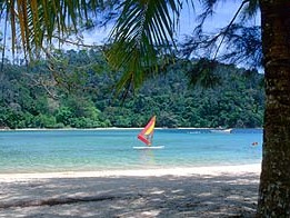
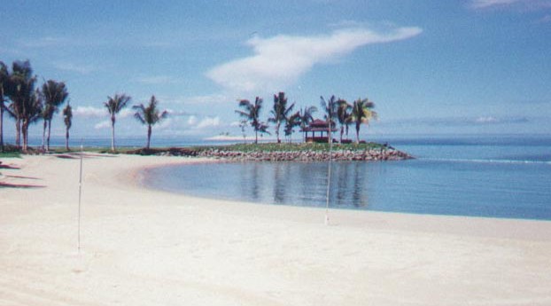
Api Island Beach
In Abdul Rahman Park
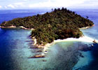
Tunku Abdul Rahman Park |
Kota Kinabalu, Malaysia
Shore Excursions
BKI-1
Tunku Abdul Rahman Park
These five islands in
Gaya Bay became Sabah's first national park in 1923 and were gazetted in an
effort to protect their coral reefs and sandy beaches. Geologically, they
are part of the Crocker Range formation; as sea levels rose after the last
ice age, they became isolated and are fringed by coral reefs.
Atkinson Clock Tower and
Likas Bird Sanctuary
This old clock tower
dates from 1905 and was named after Jesselton's first district officer.
Malaysia is famed for its varied bird life. In the bird sanctuary you may
see larger birds such as the megapode, the white-bellied sea eagle, the pied
hornbill and the green heron. Smaller birds are the most common, like
sandpipers, pink-necked green pigeons, the many species of bulbuls, bablers,
flycatchers, swiftlets and sunbirds.
Kampong Likas
Homes are built on stilts
over the water in this typical fishing village.
State Mosque and Sabah
Museum
Masjid Sabah completed in
1975, is the second-biggest mosque in Malaysia, accommodating 5,000
worshippers; it is a fine example of contemporary Islamic architecture. It
has the largest honey-comb dome in the world. This museum, designed to look
like a longhouse, has a fascinating ethnographic section, as well as a
collection of artifacts from Sabah tribes. The archaeological section
contains a magnificently carved coffin found in a limestone cave in the
Madai area. The botanical gardens are on the hillside below the museum
complex.
Tanjung Aru Beach
This is the best beach after those in Tunku Abdul Rahman National Park and
the most popular. From here your tour takes you back to the port. |


